Join Stewart Long from publiclaboratory.org in a DIY map making and aerial photography workshop.
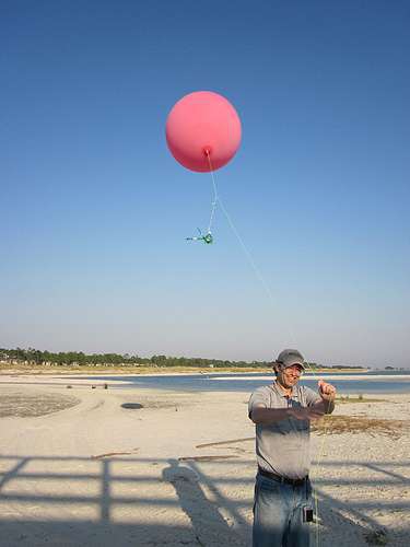
The Public Lab balloon and kite aerial imaging tool is a collaboratively designed, low-cost, fun, and relatively easy activity for making amazing high resolution aerial image maps. Here is a rundown of the schedule for the workshop.
Start
Introduction to aerial image mapping and general aerial photography. Review the history of aerial photography, satellites, and the aerial imaging industry.
DIY
Balloon/Kite mapping activity explained, collaborative tool design processed discussed.
Planning
Group looks at neighborhood map together and selects mapping focus of the day, site specific discussion rundown of how we will do the field work in this particular situation
Safety
Before the group walks out to do field work we will talk about any possible hazards and how to safely complete the field work
Image Acquisition
We will step outside, fill our balloon and proceed to move around and map our area of interest.
Map Production
Introduction to the open source tool; MapKnitter. We will learn how to start a new project and create a map from the imagery we just collected outside.
Continued
Map project may end that day or may be left to the participants to complete depending on time left and the size of the map
More information on Balloon & Kite Mapping can be found here